
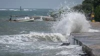
The investigation into the tragic maritime incident involving KM Virgo Transport 8 has entered a critical analytical phase as researchers from the National Research and Innovation Agency (BRIN) release detailed oceanographic findings regarding the sea conditions at the time of the disaster. The passenger and cargo vessel went missing in the Java Sea, triggering a massive ongoing search and rescue operation involving hundreds of personnel from various national agencies. While search and rescue teams battle challenging marine conditions to locate remaining survivors and victims, scientific experts have begun reconstructing the exact environmental factors that the vessel encountered on the night it lost contact.
Comprehensive Oceanographic and Meteorological Breakdown
According to the comprehensive analysis conducted by Widodo Setiyo Pranowo, a researcher at BRIN’s Research Center for Climate and Atmosphere, the sea conditions at the incident site featured notable wave activity, though they fell short of extreme classifications. Evaluating the hydrodynamic parameters, researchers determined that the significant wave height hovered around 1.56 meters with a wave period of approximately six seconds.
Within standard maritime safety and navigation classifications, a wave height ranging from 1.25 to 2.50 meters is categorized as moderate. The threshold for high seas begins at 2.50 meters, while very high seas are classified starting at four meters.
Furthermore, data indicates that roughly 96 percent of the wave height recorded on the night of the incident was generated locally by surface winds rather than long-distance swells propagating from distant oceanic regions. Based on the specific characteristics and periods of these waves, surface wind speeds were estimated to range between 6.4 and 8.3 meters per second, equivalent to 12 to 16 knots, placing them securely within the Beaufort scale 4 to 5 range.
The directional analysis revealed that the waves approached the vessel from the southeast to the east, hitting at approximately 122 degrees. Geometrically, this trajectory meant the waves struck the ship from the side, a phenomenon known in naval architecture as beam seas. Such conditions inherently cause a vessel to experience repetitive rolling motions.
Vessel Dynamics and Stability Assessment
To understand how KM Virgo Transport 8 interacted with these environmental forces, researchers performed dynamic modeling based on the vessel’s reported physical dimensions, which include a length of approximately 119 meters and a beam width of 21 meters. The wave period was estimated between 5.66 and 6.47 seconds, whereas the natural rolling period of a vessel of this size and stability profile typically spans 11 to 18 seconds.
The significant divergence between these two periods indicates that resonance—a dangerous phenomenon where wave frequency matches a ship’s natural rolling frequency and amplifies instability—did not occur in the analyzed scenarios.
Under these specific parameters, the calculated list or heel angle induced by the waves was projected at approximately 5.9 degrees under normal conditions, rising to between 11.2 and 11.9 degrees under peak wave loading. Additionally, wind contributions to the vessel’s inclination were calculated at less than half a degree.
These figures remain well below the approximate 25-degree threshold used in marine stability studies as an early indicator for water ingress through deck openings. More importantly, they are substantially lower than the 50-to-60-degree range typically associated with a complete loss of positive stability and a ship’s inability to right itself.
Implications for Search and Rescue Operations
Beyond explaining the physical sea state, the BRIN analysis offers critical operational insights designed to refine the ongoing search and rescue (SAR) matrix. The study highlighted the Stokes drift component generated by surface waves, which accounts for an estimated average of 41.2 percent of the total surface current.
Researchers emphasized that drift predictions failing to account for this wave-induced component risk generating inaccurate drift trajectories, which could misdirect search grids. Moreover, marine currents at the site were observed to reverse direction in alignment with a roughly 24-hour tidal cycle. This cyclical shift demands constant recalibration of search sectors as operations transition from one tidal phase to the next.
Regarding the recovery of the vessel, the analysis noted that the seafloor at the incident location lies at a depth of approximately 27 meters. This relatively shallow depth is conducive to employing advanced underwater survey technologies, including multibeam echosounders, side-scan sonars, remotely operated vehicles (ROVs), and professional diving operations, subject to the protocols and authority of the agencies leading the investigation.
Chronology of Events and Voyage Details
The sequence of events leading to the deployment of maritime authorities began when KM Virgo Transport 8 departed from its origin port in Surabaya, East Java, on Saturday, September 12, bound for Banjarmasin in South Kalimantan. The vessel was carrying a substantial manifest totaling 243 individuals, encompassing paying passengers, ship officers, and crew members.
In the early hours of Sunday, September 13, at approximately 02:00 Central Indonesia Time (Wita), the vessel abruptly lost contact with maritime communications while navigating the Java Sea. The sudden disappearance prompted an immediate emergency response, mobilizing naval assets, the National SAR Agency (Basarnas), and coast guard units to scour the designated maritime corridors.
As the response operation progressed into Tuesday, September 15, official figures released by rescue coordinators revealed that 114 out of the 243 individuals registered on board had been accounted for. Among the survivors and casualties recovered, 108 individuals were found alive, while six tragically lost their lives. Meanwhile, intensive search efforts continue for the remaining 129 people still listed as missing.
Institutional Responses and Broader Industry Impact
The incident has reverberated across Indonesia’s national maritime sector, renewing intense scrutiny regarding vessel safety protocols, weather monitoring compliance, and passenger manifest management, particularly during seasonal transitions marked by unpredictable sea conditions.
Maritime authorities, transportation safety committees, and meteorological agencies are collaborating closely to synthesize the physical evidence retrieved from the site with digital tracking data and eyewitness accounts from survivors. While preliminary scientific assessments by institutions like BRIN help isolate physical variables such as wave height, wind speed, and dynamic stability, comprehensive inquiries into the ultimate root causes of the disaster remain ongoing.
Transportation safety experts stress that maritime accidents of this magnitude rarely stem from a single environmental factor. Instead, investigators will likely examine a complex interplay of variables, including cargo distribution, mechanical integrity, real-time navigational decision-making, and adherence to weather advisory bulletins issued prior to departure.
As search and rescue teams press forward against adverse weather and time constraints, the focus remains dual-pronged: exhausting every possible avenue to locate the missing passengers and crew, and securing verifiable forensic and oceanographic data to prevent future maritime tragedies in Indonesian waters.
