
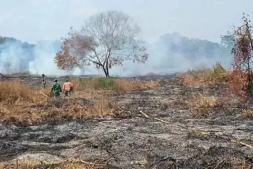
Forest and land fires, locally known as kebakaran hutan dan lahan or karhutla, have once again drawn intense scrutiny across the Indonesian archipelago as satellite monitoring systems register a sharp upward trajectory in thermal anomalies. According to official data released by the Ministry of Forestry, the total number of detected hotspots nationwide escalated to 338 points during the latest observation cycle. This sudden spike represents a concerning reversal in short-term containment trends, putting disaster management agencies, environmental authorities, and regional governments on high alert.
The most alarming development in this recent surge centers on Central Kalimantan, a province historically vulnerable to severe seasonal peatland blazes. Ministry officials confirmed that the region experienced the most significant jump in thermal activity, underscoring the volatile nature of fire management during transitional weather patterns. As environmental scientists and disaster mitigation teams scramble to deploy resources to vulnerable zones, the latest figures underscore the persistent threat that land clearing practices, prolonged dry spells, and subterranean peat ignition pose to ecological stability, public health, and regional diplomatic relations.
Escalation of Thermal Anomalies: A Quantitative Breakdown
The acceleration of fire indicators became starkly apparent in the daily monitoring logs compiled by the Ministry of Forestry. Up until Thursday, November 5, 2026, at 21:00 Western Indonesia Time (WIB), the cumulative count of high-confidence hotspots identified across the country reached 338. This figure marks a substantial increase of 123 points compared to just twenty-four hours prior, when national monitoring systems recorded 215 hotspots.
The localized impact is heavily concentrated in specific geographical sectors. Within the six designated priority provinces targeted by the Indonesian government for intensive karhutla mitigation, the aggregate number of hotspots climbed from 41 to 86 points within the same single-day timeframe.
Ristianto Pribadi, the Head of the Bureau for Public Relations and Foreign Cooperation at the Ministry of Forestry, detailed the distribution of these thermal alerts during an official briefing on Friday, November 6, 2026. Central Kalimantan absorbed the brunt of the escalation, with its hotspot count leaping dramatically from 37 to 85 points. Meanwhile, neighboring Kalimantan Selatan registered a single isolated hotspot. Conversely, several other historical fire-prone provinces—namely Jambi, West Kalimantan (Kalimantan Barat), South Kalimantan’s neighbor South Sumatra, and Riau—reported zero high-confidence hotspots during this specific observation window.
Despite the sharp statistical climb, ministry officials have urged caution in interpreting raw satellite data. Ristianto emphasized that a numerical rise in thermal hotspots does not automatically equate to an identical number of active fire outbreaks, nor does it immediately define the total land area impacted by flames.
"The number of hotspots cannot be directly equated with the number of fire incidents or the total burned area. All indications must still be verified directly in the field," Ristianto stated, highlighting the technical limitations of satellite remote sensing, which can occasionally misinterpret non-fire heat sources, such as industrial rooftops, sun-baked exposed rock, or agricultural clearing activities that do not involve uncontrolled burning.
Meteorological Factors and the Chronology of the Surge
The timing of this recent surge coincides with complex meteorological dynamics currently influencing the equatorial maritime continent. Indonesia’s tropical climate, characterized by alternating monsoons, makes its vast forest reserves and extensive carbon-rich peatlands exceptionally susceptible to ignition during periods of reduced rainfall and elevated surface temperatures.
In the weeks leading up to the November 2026 spike, meteorological agencies had noted patchy rainfall distribution across the islands of Sumatra and Kalimantan. While some regions experienced localized downpours, other districts faced prolonged dry spells that rapidly desiccated surface vegetation and lowered the water table in critical peatland zones. Peatlands, which consist of compressed layers of partially decayed organic matter accumulated over millennia, represent a dual challenge for firefighters
. When dry, they become hyper-flammable. Once ignited, they can burn underground for weeks or months, defying surface suppression efforts and emitting massive plumes of carbon dioxide and particulate matter into the atmosphere.
The chronology of the current escalation points to a rapid mobilization phase. Early in the week, baseline monitoring indicated a relatively stable situation, with national hotspots hovering around the low two hundreds. However, shifting wind patterns and localized drops in relative humidity appear to have created micro-climates conducive to fire ignition. By Thursday evening, satellite passes captured the clustering of thermal signatures in the interior districts of Central Kalimantan, prompting automated alerts within the Ministry of Forestry’s environmental monitoring framework. Ground teams were immediately notified to cross-reference the satellite data with localized weather reports and visual sightings.
The Human Toll and Institutional Grief
While technical agencies analyze satellite feeds and coordinate ground verification, the human cost of combating karhutla remains a somber backdrop to these operational updates. The physical danger faced by firefighters, military personnel, and volunteers on the front lines cannot be overstated.
Just prior to the latest ministry briefings, the national consciousness was shaken by tragedy. The Indonesian government and the highest levels of the state apparatus formally conveyed profound condolences following the line-of-duty deaths of three Indonesian National Armed Forces (TNI) personnel. These soldiers perished while actively engaged in suppression operations, battling aggressive flames in remote terrain to prevent fires from engulfing local communities and vital ecosystems.
The sacrifice of these frontline responders serves as a grim reminder of the high stakes involved in national fire management. Fighting karhutla requires navigating treacherous terrain, enduring toxic smoke inhalation, managing heavy mechanical equipment in extreme heat, and confronting unpredictable fire behavior driven by shifting winds and dry tinder. Their passing has intensified calls from civil society organizations and lawmakers for enhanced safety protocols, advanced personal protective equipment, and better aerial support for personnel deployed to high-risk zones.
Strategic Interventions in Priority Provinces
The Indonesian government maintains a rigorous, multi-tiered approach to combating forest and land fires, focusing heavily on six priority provinces known for their vast expanse of vulnerable peatlands and historical fire incidents. These provinces include Riau, Jambi, South Sumatra, West Kalimantan, Central Kalimantan, and South Kalimantan.
Mitigation strategies rely heavily on a combination of preventive patrolling, early detection systems, law enforcement against illegal land-clearing syndicates, and rapid-response suppression tactics. When hotspot numbers escalate, the National Disaster Management Agency (BNPB), working in tandem with the Ministry of Environment and Forestry, the TNI, the National Police (Polri), and local disaster mitigation agencies (BPBD), activates pre-positioned task forces.
In Central Kalimantan, where the recent surge was most pronounced, provincial disaster teams immediately moved from a monitoring posture to active deployment following the Thursday evening satellite reports. Ground verification units—often comprising Manggala Agni (the forestry ministry’s specialized fire brigade), military personnel, police officers, and local community volunteers known as Masyarakat Peduli Api (MPA)—were dispatched to investigate the 85 identified coordinates.
These ground teams utilize specialized off-road vehicles, portable water pumps, and trenching tools to suppress surface fires before they can penetrate deeper into the peat layers. Concurrently, regional authorities review the necessity of requesting weather modification technology, commonly known as cloud seeding, to induce artificial rainfall over parched districts if atmospheric conditions prove favorable.
Broader Environmental, Economic, and Health Implications
The resurgence of karhutla, even in localized bursts, carries profound implications that extend far beyond national borders. Ecologically, the burning of tropical rainforests and peatlands releases vast quantities of greenhouse gases into the global atmosphere, counteracting international carbon-reduction efforts and accelerating global climate change. Furthermore, these fires threaten critical habitats for endangered species, including the Bornean orangutan, proboscis monkeys, and numerous endemic bird and plant species whose survival depends on the integrity of their forest ecosystems.
From a public health perspective, unchecked fires generate dense, acrid haze containing high concentrations of PM2.5 particulate matter. When winds carry this haze across population centers, it triggers a spike in acute respiratory infections (ARIs), eye irritation, and cardiovascular ailments among vulnerable demographics, particularly children and the elderly. Prolonged haze episodes also force the temporary closure of schools, disrupt regional aviation schedules due to reduced visibility, and undermine local economic productivity.
Economically, the recurrence of severe fire seasons places a heavy financial burden on the state budget. Expenditures dedicated to water-bombing helicopters, ground personnel logistics, health interventions, and post-fire ecological restoration run into the trillions of rupiah. Moreover, prolonged environmental crises can damage Indonesia’s international reputation regarding sustainable commodity production, particularly concerning palm oil and timber supply chains, which face stringent scrutiny from global export markets.
Future Outlook and Continuous Monitoring
As Indonesia navigates the remainder of the dry transition period, vigilance remains the cornerstone of national policy. The Ministry of Forestry, alongside its institutional partners, continues to operate round-the-clock monitoring centers to track atmospheric conditions, soil moisture levels, and thermal anomalies.
While the jump to 338 hotspots serves as a sobering wake-up call, authorities stress that institutional preparedness is significantly more robust today than during historical crisis years, bolstered by improved inter-agency coordination, community-level engagement, and advanced predictive modeling. Nevertheless, the ultimate containment of karhutla requires an ongoing synthesis of rigorous satellite surveillance, swift ground verification, unwavering law enforcement against illegal burning, and favorable weather patterns to ensure that localized spikes do not metastasize into widespread ecological and humanitarian emergencies.
