
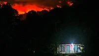
Indonesia sits at the heart of the Pacific Ring of Fire, a vast, horseshoe-shaped belt characterized by intense seismic and volcanic activity. With 127 active volcanoes scattered across its archipelago, the nation contends with one of the most complex geological landscapes in the world. However, recent discussions among leading geologists and former government officials have highlighted a stark reality: despite the frequency and severity of volcanic threats, the nation’s monitoring infrastructure remains alarmingly uneven.
While Mount Merapi in Central Java boasts a world-class, comprehensive monitoring suite, the vast majority of other active volcanoes rely on limited, rudimentary equipment. Experts argue that this technological disparity, coupled with institutional limitations within the Center for Volcanology and Geological Hazard Mitigation (PVMBG), poses a significant challenge to the nation’s disaster resilience and emergency response capabilities.
The Landscape of Volcanic Risk
Indonesia’s volcanic activity is primarily categorized by the PVMBG, an agency operating under the Geological Agency of the Ministry of Energy and Mineral Resources (ESDM). Of the 127 active volcanoes, 76 are classified as Type A—the most hazardous category, defined as volcanoes that have erupted magmatically at least once since 1600 AD. These are the primary focus of the government’s monitoring efforts.
Agung Harijoko, a volcanologist from the Faculty of Geography at Gadjah Mada University (UGM), emphasizes that the current monitoring infrastructure is far from uniform. During a recent discourse at UGM in Sleman, Yogyakarta, Harijoko noted that while seismic sensors—the bedrock of volcanic monitoring—are present at most critical sites, the depth and breadth of data collection vary significantly.
"From the standpoint of quantity and observation posts, the facilities remain highly disparate," Harijoko explained. "Mount Merapi represents the gold standard. It is equipped with the most complete, technologically advanced surveillance systems currently available in Indonesia. For other volcanoes, particularly those in remote areas, we have established geophysical stations, but the technological density is nowhere near the level of Merapi."
The Challenges of Remote Monitoring
For volcanoes located in geographically isolated areas, the PVMBG relies on remote data transmission. These posts typically utilize seismometers to detect tremors, which are the primary indicators of magma movement. While these stations provide essential data, they are often limited in their analytical capabilities compared to integrated systems that incorporate GPS deformation monitoring, gas emission sensors, and thermal imaging.
A significant hurdle identified by experts is the communication gap. Information collected at remote posts is funneled to the PVMBG headquarters in Bandung, where experts analyze the data and disseminate warnings via social media and official channels. However, the relay of this information to local populations living in the shadow of these mountains remains a logistical challenge. In areas with limited internet access or poor telecommunication infrastructure, the "last mile" of the early warning system—ensuring the information reaches the people who need it most—is frequently compromised.
The Institutional Debate: An Echelon II Struggle
The push for a more robust monitoring network is tied to a broader debate regarding the institutional status of the PVMBG. Dwikorita Karnawati, the former head of the Meteorology, Climatology, and Geophysics Agency (BMKG), has been a vocal proponent of restructuring the agency to elevate its authority and budgetary access.
Currently, the PVMBG is categorized as an Echelon II unit under the Geological Agency of the Ministry of ESDM. Dwikorita argues that this placement is problematic. "Because it is situated within the Ministry of ESDM—a ministry with a heavy focus on mineral resources and energy management—disaster mitigation often ends up as a low-priority budgetary item," she stated.
Dwikorita draws a parallel to the elevation of the BMKG, which was upgraded from an Echelon unit to a state-level agency during the presidency of Megawati Soekarnoputri. This move was not merely bureaucratic; it allowed the BMKG to command the budget, technology, and mandate required to provide real-time, nationwide early warnings for weather and seismic events. She suggests that the PVMBG requires a similar trajectory—or, ideally, a merger with the BMKG—to overcome the constraints of its current institutional hierarchy.
Proposed Integration: Learning from Japan
The proposal to integrate the PVMBG into the BMKG has been a subject of internal government deliberation for years, including formal suggestions made by Dwikorita in 2019 and 2023. The logic behind this integration is based on the necessity for a unified early warning command center.
"The lesson we learned is that we cannot issue comprehensive early warnings because the facilities, monitoring equipment, and technical data are held by the PVMBG, while the mandate for issuing public alerts often rests with the BMKG," Dwikorita explained. "We cannot perform the necessary analysis if the data and the warning system are siloed in different agencies."
This model is heavily inspired by the Japan Meteorological Agency (JMA), which serves as a singular authority for all atmospheric, oceanic, and geological hazards. In Japan, the integration of volcanic, seismic, and tsunami monitoring allows for near-instantaneous analysis. When a volcano erupts or a tremor occurs, the JMA’s centralized system processes data from all sensors simultaneously, drastically reducing the time required to issue life-saving alerts.
Economic and Strategic Implications
The argument for institutional reform is not without its critics, particularly those who emphasize the unique geological expertise required for mineral exploration and groundwater management, which remain the core functions of the Geological Agency. However, Dwikorita stresses that the proposed integration would only encompass the disaster mitigation and monitoring components of the PVMBG.
"We are not suggesting that the entire Geological Agency be absorbed," she clarified. "The agency has broad responsibilities regarding mineralogy, water, and energy that are outside the scope of the BMKG. We are specifically targeting the hazard mitigation and monitoring functions, where there is currently significant, and perhaps inefficient, duplication of tasks."
The economic implications of better monitoring are profound. Volcanic eruptions in Indonesia have historically caused significant disruptions to aviation, agriculture, and local economies. The 2010 eruption of Mount Merapi, for instance, necessitated the evacuation of hundreds of thousands of people and caused widespread damage to agricultural land. Advanced, real-time monitoring allows for more surgical evacuation orders, minimizing economic disruption while maximizing public safety.
Future Outlook and Technological Requirements
As the frequency of volcanic activity remains a constant in Indonesia, the need for a technology-led approach becomes non-negotiable. Modern volcano monitoring requires more than just seismometers; it demands the deployment of satellite-based Interferometric Synthetic Aperture Radar (InSAR) to track ground deformation, drone-based gas analysis, and AI-driven data processing systems that can filter through noise to identify pre-eruptive signals.
The current budgetary constraints mean that the implementation of these technologies is often piecemeal. Without a central agency that prioritizes the acquisition of these assets, the "Merapi-standard" of safety will likely remain a luxury rather than the national baseline.
For now, the PVMBG continues its mission under the existing structure, providing critical service to the nation despite the administrative hurdles. However, as the discourse among academics and former officials intensifies, the pressure on the government to modernize the institutional framework for disaster management is growing. The consensus among experts is clear: the safety of millions of Indonesians living in the shadow of active volcanoes depends on closing the gap between the nation’s geological reality and its monitoring capability.
Whether the government chooses to elevate the PVMBG within the Ministry of ESDM or pursues a structural merger with the BMKG, the goal remains the same: a seamless, technologically advanced, and well-funded system capable of transforming data into life-saving action in the face of the archipelago’s inevitable volcanic threats.