
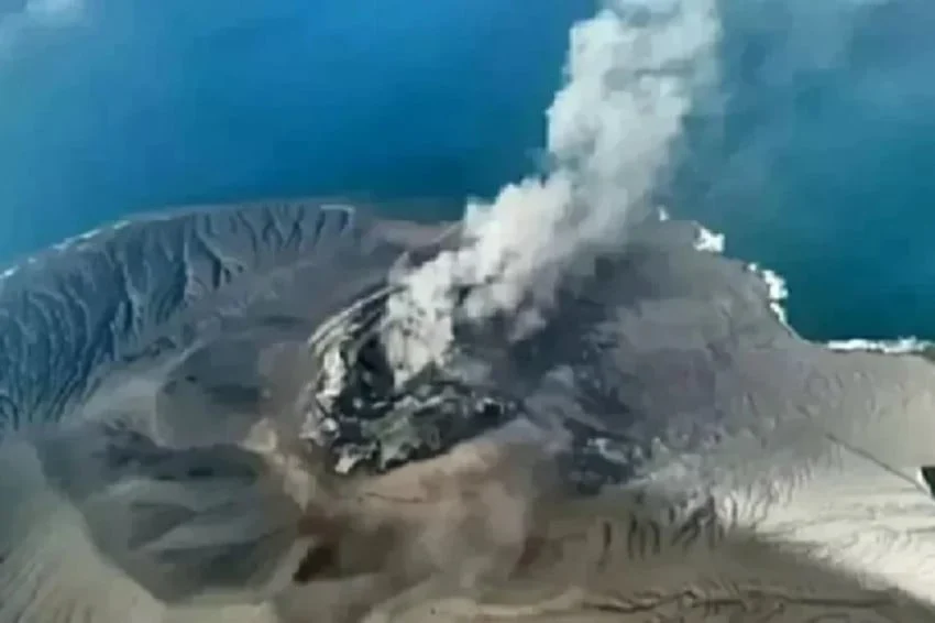
The geological observatory networks across the Sunda Strait recorded a sudden and intense escalation in volcanic activity as Mount Anak Krakatau unleashed a rapid series of eruptions on Saturday evening, October 31, 2026. According to official reports released by the Center for Volcanology and Geological Hazard Mitigation (PVMBG), operating under Indonesia’s Ministry of Energy and Mineral Resources, the stratovolcano produced 12 distinct eruption episodes in quick succession. The geological disturbance began shortly after sunset, initiating a tense window of heightened monitoring for volcanologists, disaster mitigation authorities, and coastal communities residing along the shores of the Sunda Strait in both Banten and Lampung provinces.
The intensification of volcanic pulses underscores the notoriously volatile nature of Mount Anak Krakatau, a geological descendant of the legendary Krakatoa that collapsed and triggered a catastrophic tsunami in 1883. While Saturday evening’s sequence of eruptions did not immediately register as a large-scale structural collapse, the sheer frequency of the bursts within a relatively narrow timeframe has compelled authorities to maintain strict safety radiuses and reiterate preparedness measures among residents and marine operators in the region.
Chronology of the October 31 Eruption Sequence
The geological sequence commenced during the early evening hours, catching monitoring stations by surprise due to the abrupt transition from baseline tremor activity to rhythmic eruptive pulses. Data compiled by PVMBG through the MAGMA Indonesia observation network documented the exact timeframe of the active phase.
The 12 consecutive eruptions unfolded between 18.30 Western Indonesia Time (WIB) and 20.39 WIB. Unlike daytime events where ash plumes and pyroclastic material can be easily tracked via optical cameras, the nocturnal timing of this sequence presented immediate observation challenges. Official reports from the monitoring post indicated that despite the confirmed instrumental detection of the eruptions, the dense darkness obscured direct visual confirmation of the ash columns or crater morphology. Furthermore, seismographs and acoustic sensors at nearby observation posts recorded no audible booming sounds or heavy rumbling tremors associated with the bursts, suggesting a localized, effusive-to-strombolian style of activity that concentrated energy release primarily within the conduit system.
Despite the absence of loud acoustic signals, the rapid-fire succession of 12 events within roughly two hours pointed to a pressurized magma chamber seeking immediate relief through the central vent. Volcanologists immediately initiated continuous data streaming to analyze the frequency of the seismic swarms and determine whether further escalating pulses could follow.
Exclusion Zones and Official Safety Directives
In direct response to the nocturnal eruptive sequence, the PVMBG issued immediate updates to the public safety parameters surrounding the volcanic island. The agency reiterated that the active status of Mount Anak Krakatau remains firmly at Level III (Siaga, or Standby), the second-highest tier on Indonesia’s national volcano alert system.
Under the enforced safety regulations, all commercial, fishing, and recreational activities are strictly prohibited within a 5-kilometer radius from the active central crater. In addition, a separate restriction mandates a 1-kilometer exclusion zone surrounding Pulau Baru, an adjacent landform shaped by historical eruptive deposits and secondary geological formations. These buffer zones are designed to protect maritime traffic, fishermen, and tourists from the immediate hazards of sudden ballistic projectiles, localized ballistic debris, and sudden thermal surges.
The PVMBG specifically highlighted several secondary and primary hazards that continue to threaten the immediate vicinity of the cone. These include the potential high-velocity projection of incandescent rock fragments (balistik batu pijar), dense showers of volcanic ash driven by shifting winds, and the ever-present threat of secondary eruptions triggered by collapsing unstable material sliding down the steep submarine flanks of the edifice into the surrounding waters of the Sunda Strait.
Addressing Public Anxiety and Mitigating Misinformation
The echoes of past disasters in the Sunda Strait region mean that any sudden intensification of activity from Mount Anak Krakatau frequently generates anxiety among coastal populations in Lampung and Banten. Recognizing the psychological impact of the October 31 eruptions, regional disaster management authorities (BPBD) and central mitigation agencies swiftly moved to counter misinformation circulating on social media platforms.
Within hours of the seismic alert, rumors regarding an imminent or triggered tsunami began to circulate across messaging applications, threatening to spark panic in coastal villages. The PVMBG, in coordination with the Meteorology, Climatology, and Geophysics Agency (BMKG), issued definitive statements urging the public to remain calm and disregard unverified claims. Authorities emphasized that while the volcano is actively erupting, the volume of material displaced thus far is insufficient to trigger a submarine mass failure capable of generating a major tsunami wave.
Coastal communities, particularly along the southern coast of Lampung and the western coastline of Banten, have been instructed to continue their daily routines normally, provided they adhere strictly to the established exclusion zones and heed official updates disseminated exclusively through authorized government channels. Local BPBD units have ramped up coordination with village heads and community leaders to ensure that accurate, science-based information reaches vulnerable populations without delay.
Geological Background and Evolution of Mount Anak Krakatau
To understand the significance of the October 2026 events, it is necessary to examine the unique geological pedigree of Mount Anak Krakatau, which translates to "Child of Krakatoa." The island emerged from the submerged caldera left behind by the cataclysmic 1883 eruption of Krakatoa—an event that destroyed two-thirds of the original island complex, generated towering tsunami waves exceeding 40 meters, and claimed tens of thousands of lives.
First breaching the water’s surface in 1927, Anak Krakatau has since grown rapidly through episodic vertical and lateral accumulation of lava flows, tephra, and pyroclastic debris. Its growth rate averages several meters per year, making it one of the most dynamic and closely monitored volcanic systems in the world. However, this rapid growth results in an inherently unstable edifice characterized by steep, unconsolidated slopes resting on weak submarine foundations.
This structural vulnerability was dramatically demonstrated in December 2018, when a major flank collapse during an eruptive phase triggered a destructive tsunami along the coasts of Banten and Lampung, resulting in over 400 fatalities. Since that disaster, monitoring systems—including deep-sea tide gauges, tiltmeters, seismographs, and continuous satellite radar interferometry—have been significantly upgraded to provide early warnings of structural deformation or accelerated magma ascent.
Implications for Regional Maritime Traffic and Aviation
The ongoing volcanic unrest at Mount Anak Krakatau carries significant implications for regional transportation networks, particularly concerning maritime navigation and commercial aviation across the Sunda Strait—one of the busiest maritime chokepoints in Southeast Asia.
Vessels transiting the Sunda Strait between the islands of Java and Sumatra have been issued formal navigational warnings (Notices to Mariners) to maintain a wide berth around the active volcanic cone. While major shipping lanes operate at a safe distance from the 5-kilometer exclusion zone, localized ash fallout and floating pumice rafts can pose minor hazards to engine cooling systems and navigation equipment for smaller vessels and local fishing boats.
For the aviation sector, AirNav Indonesia and the Volcanic Ash Advisory Center (VAAC) in Darwin, Australia, routinely monitor atmospheric conditions surrounding the strait. Although Saturday night’s eruptions did not produce towering ash columns that disrupted major international flight paths into Jakarta’s Soekarno-Hatta International Airport, localized aviation codes (VONA – Volcano Observatory Notice for Aviation) remain on alert. Airlines operating regional turboprop and charter routes across the strait are advised to monitor real-time trajectory forecasts to avoid low-level ash plumes that could compromise turbine integrity.
Preparedness and Future Outlook
As Indonesia navigates its peak rainy season intersecting with heightened volcanic activity, disaster management experts point out that secondary hazards present a continuous threat. Heavy tropical downpours falling on fresh volcanic ash deposits accumulated on the slopes of Anak Krakatau can mix with loose tephra to form hazardous cold lahars (mudflows) should material be transported to surrounding landmasses, though the volcano’s insular setting largely confines direct lahar impacts to the immediate marine environment.
Nevertheless, the prompt detection and rapid dissemination of data regarding the October 31 eruptions demonstrate the maturation of Indonesia’s multi-hazard early warning architecture. The integration of real-time seismic monitoring, automated data processing via the MAGMA platform, and immediate inter-agency coordination between the PVMBG, BMKG, and local BPBD offices ensures that response mechanisms remain agile.
Authorities have confirmed that monitoring posts will maintain round-the-clock surveillance of Mount Anak Krakatau’s subterranean movements. As long as the volcano remains at Level III Siaga, residents, tourists, and maritime operators are urged to maintain constant vigilance, respect established safety boundaries, and rely exclusively on official bulletins issued by the Ministry of Energy and Mineral Resources to ensure community safety across the Sunda Strait region.