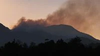
The recurring phenomenon of forest and land fires (kebakaran hutan dan lahan or karhutla) poses significant environmental, economic, and public health challenges across Southeast Asia, most notably in Indonesia. Beyond the immediate destruction of flora and fauna, these fires generate dense smoke and particulate matter that frequently drift across regional boundaries, severely degrading air quality and disrupting daily life. In an era of advanced geospatial technology, mitigating these hazards increasingly relies on digital transparency and public empowerment. By leveraging sophisticated platforms provided by national meteorological agencies and international space organizations, citizens and policymakers alike can now track the dispersion of smoke in real time. Access to these tools is no longer a luxury reserved for scientists; it is a vital public health necessity that allows vulnerable populations to anticipate poor air quality, enables aviation authorities to safeguard flight paths, and provides governments with empirical data to coordinate emergency responses.
Understanding the Chronology and Background of Karhutla
Forest and land fires in Indonesia are deeply intertwined with seasonal weather patterns, specifically the prolonged dry seasons often exacerbated by climate phenomena such as El Niño. Historically, the escalation of hotspots typically begins during the peak dry months, generally spanning from July to October. During this period, prolonged droughts dry out peatlands and underbrush, making them highly combustible. While some fires are ignited naturally by lightning strikes or extreme surface temperatures, a significant portion has historically been linked to land-clearing practices for agriculture and plantation development.
The progression of a typical karhutla event follows a distinct timeline. It usually starts with localized thermal anomalies—detectable as hotspots by orbital satellites—which quickly escalate into widespread blazes if left unchecked. Within days, prevailing winds carry the resulting smoke plumes over hundreds of kilometers, frequently crossing provincial and international borders to blanket neighboring regions in a thick, hazardous haze. The multi-week duration of these episodes places an immense strain on local firefighting task forces, healthcare systems, and regional diplomatic relations, underscoring the urgent need for proactive monitoring and early warning systems long before fires reach crisis proportions.
The Imperative of Monitoring Smoke Dispersion
The necessity of tracking smoke distribution extends far beyond simple environmental observation; it is a multi-faceted approach to public safety and national resilience. According to the Indonesian Agency for Meteorology, Climatology, and Geophysics (BMKG), comprehensive monitoring yields critical benefits across at least eight major operational and societal domains.
Protecting Public Health
The most immediate casualty of unmonitored smoke dispersion is human health. Smoke from forest and land fires contains a complex mixture of gases and fine particulate matter, specifically PM2.5, which can penetrate deep into the human respiratory system and enter the bloodstream. Real-time smoke tracking serves as an early warning system for populations in the path of the pollution. Armed with this knowledge, citizens can take vital precautions, such as donning high-filtration masks, sealing indoor environments, and restricting outdoor physical exertion during peak pollution hours.
Safeguarding Aviation Safety
Dense haze drastically reduces horizontal and vertical visibility, creating severe hazards for commercial and regional aviation. Pilots relying on visual flight rules face extreme risks when navigating through thick smoke plumes, which can obscure runways and surrounding topography. Continuous tracking of smoke movement allows air traffic controllers and airline operators to identify compromised flight corridors, adjust flight paths proactively, and implement tactical delays or rerouting to prevent accidents.
Monitoring Air Quality Dynamics
Environmental agencies rely on smoke dispersion data to contextualize ground-level air quality index (AQI) readings. While stationary air quality monitors provide precise local data, satellite tracking illustrates the broader macro-level movement of pollutants. This integration helps authorities issue timely health advisories, close schools when necessary, and deploy mobile medical units to the hardest-hit districts.
Understanding Climatic and Atmospheric Impacts
On a global scale, massive biomass burning injects tremendous volumes of carbon dioxide, methane, and aerosols into the atmosphere, directly influencing regional weather patterns and contributing to global climate change. Atmospheric scientists utilize smoke dispersion models to study how these aerosol loads alter cloud microphysics, potentially suppressing rainfall in drought-affected zones and creating a self-reinforcing cycle of dry conditions and fire vulnerability.
Advancing Air Pollution Studies
Researchers use historical and real-time smoke trajectory data to map the lifecycle of atmospheric pollutants. By analyzing wind vectors, topographical influences, and chemical transformations within the smoke plumes, academic institutions and environmental organizations can refine predictive models, offering deeper insights into how urban and rural centers interact with regional biomass smoke.
Informing Public Policy and Governance
Empirical data regarding smoke movement provides policymakers with the objective baseline required to formulate stricter environmental regulations, enforce laws against illegal land clearing, and allocate budgetary resources more efficiently. When public officials can definitively trace smoke plumes back to specific geographic clusters of active burning, accountability mechanisms become significantly more robust.
Supporting Firefighting and Emergency Response
Tactical firefighting is inherently resource-intensive and logistically challenging. Knowing where smoke is heaviest helps incident commanders deduce the intensity and trajectory of underlying blazes, especially in remote or inaccessible terrain. This information facilitates inter-agency coordination between local disaster management agencies (BPBD), the National Disaster Management Authority (BNPB), the military, and forestry police, ensuring that personnel and water-bombing aircraft are deployed where they are most urgently needed.
Facilitating Evacuation Preparedness
In extreme scenarios where smoke toxicity reaches dangerous thresholds—particularly in regions surrounded by deep peatlands that smolder underground for weeks—local governments must contemplate evacuations, especially for vulnerable demographics such as infants, the elderly, and individuals with preexisting respiratory conditions. Smoke tracking provides the necessary lead time to establish emergency shelters, stock medical supplies, and organize safe evacuation routes.
Leveraging Digital Tools: How to Access BMKG Smoke Dispersion Data
To empower citizens with actionable intelligence, meteorological authorities have integrated satellite imagery into accessible public web portals. BMKG provides specialized resources designed to track meteorological anomalies, including potential fire weather and smoke trajectories.
To view these resources on the official BMKG platform, users can follow a structured digital navigation pathway:
- Access the official BMKG website via a secure browser connection at https://www.bmkg.go.id/.
- Navigate to the primary navigation menu and select the "Cuaca" (Weather) section.
- Locate and click on the dedicated "Peringatan Karhutla" (Forest Fire Warning) subsection.
- Select the "Citra Sebaran Asap" (Smoke Dispersion Imagery) feature.
- Review the high-resolution satellite composites displayed on the interface to assess current smoke distribution patterns across the Indonesian archipelago.
Experts emphasize that digital interfaces and menu layouts are subject to periodic user-interface updates to improve functionality. Consequently, individuals seeking critical weather and environmental data should always verify that they are accessing official BMKG channels to avoid misinformation.
Utilizing Global Observation Systems: NASA FIRMS
In addition to national resources, international satellite observation systems play an indispensable role in tracking global fire activity. The Fire Information for Resource Management System (FIRMS), operated by the National Aeronautics and Space Administration (NASA), provides rapid-response satellite data regarding active thermal anomalies and fires worldwide.
To analyze fire activity and environmental conditions using NASA FIRMS, users can employ the following steps:
- Open the NASA FIRMS web application through an updated internet browser.
- Access the "Layers" or map-layer customization menu located within the interface dashboard.
- Select appropriate satellite imagery layers, such as the Moderate Resolution Imaging Spectroradiometer (MODIS) instruments aboard the Aqua and Terra satellites, or the Visible Infrared Imaging Radiometer Suite (VIIRS) instruments flying on the Suomi NPP and NOAA-20 platforms.
- Examine the interactive map interface to identify active thermal hotspots and observe the surrounding terrain conditions.
For enhanced identification of smoke plumes, users can toggle the satellite view to display true-color or natural-color imagery, which closely mirrors what the human eye would see from orbit. However, analysts caution that distinguishing smoke from ordinary meteorological clouds, coastal fog, or high-altitude haze can occasionally present interpretive challenges without specialized atmospheric correction algorithms.
Analytical Implications and Best Practices for Data Interpretation
While digital monitoring platforms have revolutionized environmental transparency, experts stress that satellite data must be interpreted within its proper technical context. NASA FIRMS, for instance, is primarily engineered to detect active thermal anomalies—pixels on the earth’s surface radiating abnormal heat—rather than measuring downwind smoke concentration or ground-level air toxicity. A single thermal hotspot does not automatically quantify the total volume of smoke produced, nor does a visual smoke plume accurately reflect the exact particulate concentration at breathing height in a specific urban neighborhood.
Consequently, public health and meteorological experts strongly advise a multi-source validation approach. Citizens and local planners should never rely on a single satellite image or isolated data point to assess environmental safety. Instead, the most accurate safety assessments emerge from cross-referencing satellite smoke imagery with local air quality index (AQI) readings, ground-based particulate matter sensors, official meteorological forecasts, and advisory bulletins published by BMKG, the Ministry of Environment and Forestry, and local health departments.
Broad Socioeconomic and Environmental Implications
The proliferation of open-access environmental monitoring tools marks a significant shift toward digital democratization in disaster management. When communities are equipped with transparent, science-based data, civil society can engage in more constructive dialogues regarding land management reform, sustainable agricultural practices, and climate resilience. Furthermore, regional transparency reduces cross-border diplomatic friction by providing verifiable, objective data regarding the origin and trajectory of transboundary haze.
Ultimately, while technology cannot extinguish a forest fire on its own, it serves as an indispensable shield. By bridging the gap between orbital observation and ground-level awareness, digital tracking systems ensure that society is neither blind nor defenseless against the seasonal recurrence of forest and land fires. Through continued technological integration, public vigilance, and decisive institutional policy, Indonesia and the broader region can steadily mitigate the multi-layered threats posed by karhutla, safeguarding both human health and ecological integrity for future generations.